Sending files
- LAS and ZIP downloads that need desktop software
- Notes and measurements lost at export
- Layers that don’t line up
- Support calls after delivery
For survey, drone and scanning teams
Deliver drone and scanner captures to clients as one 3D link: point cloud, photoreal model, notes and photos, all in the right coordinates. Clients open it in a browser. Your data is stored in Australia.

Drone surveys and handheld scans
Send the files and your client needs software to open them. Send a video and they can’t measure anything. MapShare puts the whole capture into one interactive project on a link: accurate enough to measure from, simple enough for anyone to open, and good enough to show off. It stays live, so it keeps up with the job.
Schedule a walkthrough from the project and the invite goes out from your Outlook or Google Calendar. Everyone joins the same 3D scene, with voice and a laser pointer.
Bring in ArcGIS and OGC feature services, OpenStreetMap buildings or City of Melbourne sensor feeds. Live layers refresh while the scene is open.
Clients click a link instead of downloading a LAS file. Nothing to install, no viewer to set up, no support call to walk them through it.
The database and project files are hosted in Sydney. Large uploads are held and converted on our own servers in Australia. Share with the people you add, or publish a view-only showcase.
It all happens in the scene, on the link you send.
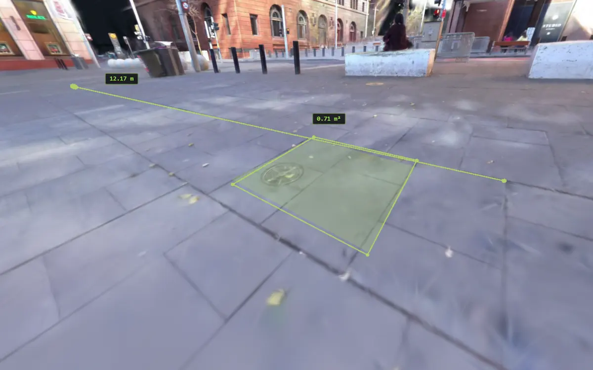
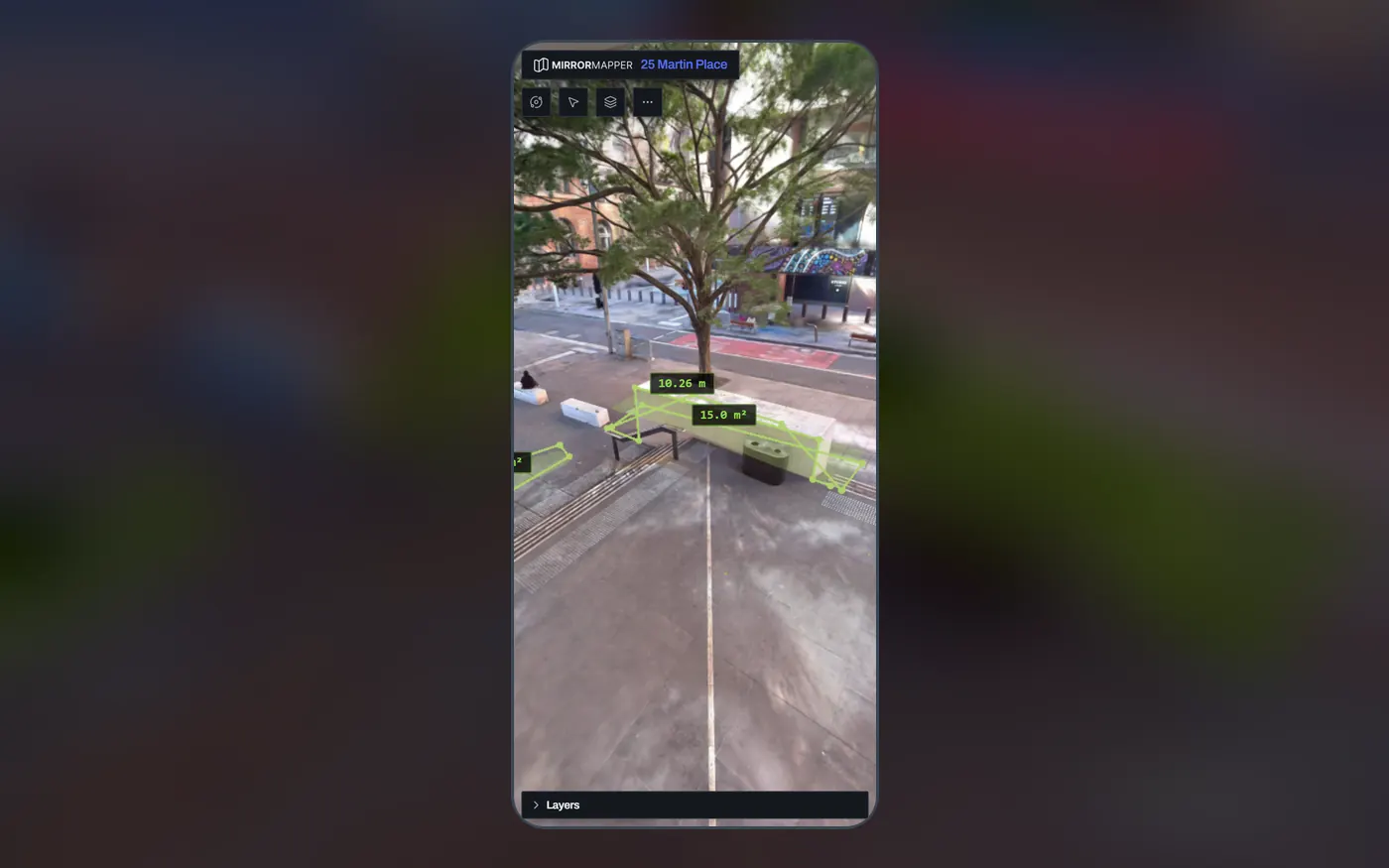
Distance, area, angle and volume, picked on the photoreal view. The numbers come from the point cloud.
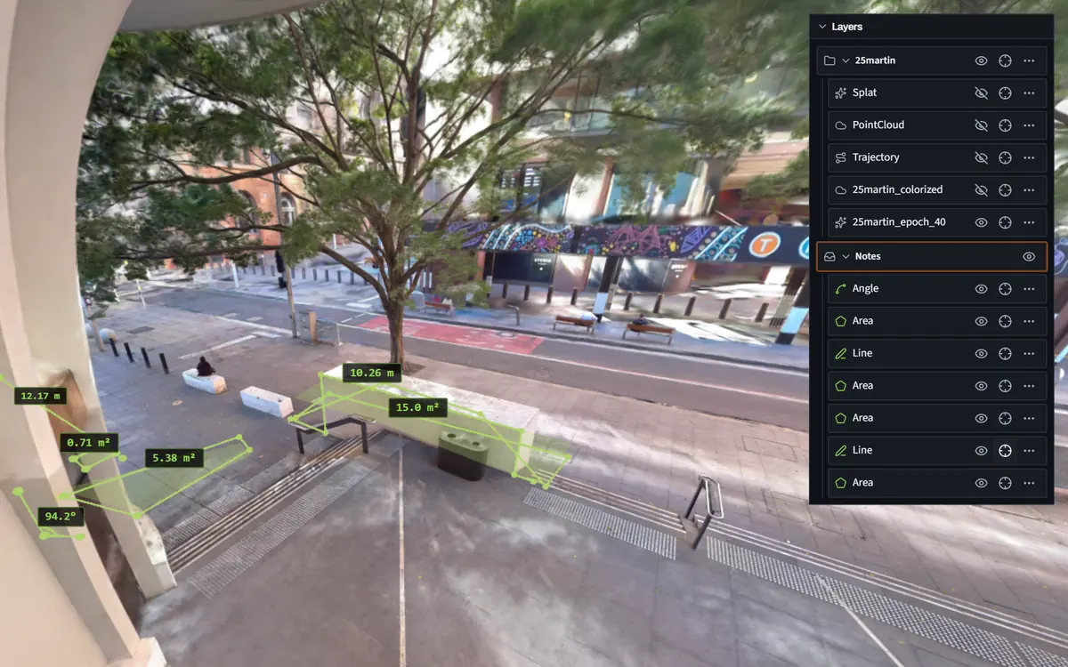
Notes, marks and photos stay in the scene, sorted into folders that viewers can switch on and off.
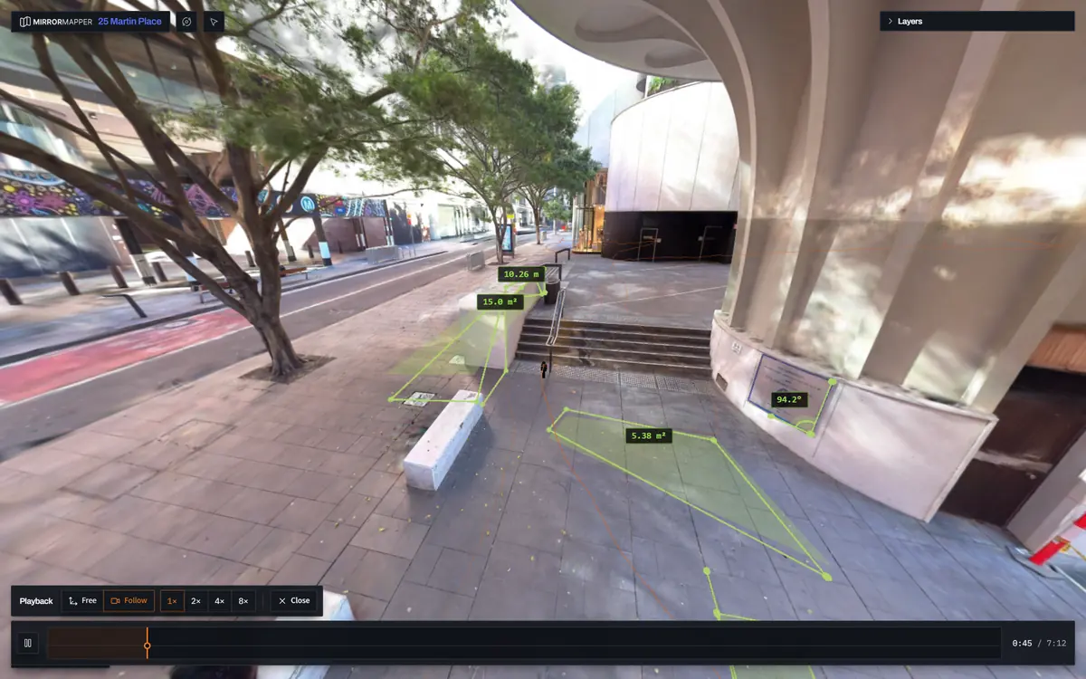
Set a camera path and export video or stills, or play a handheld scan back along the route it was walked.
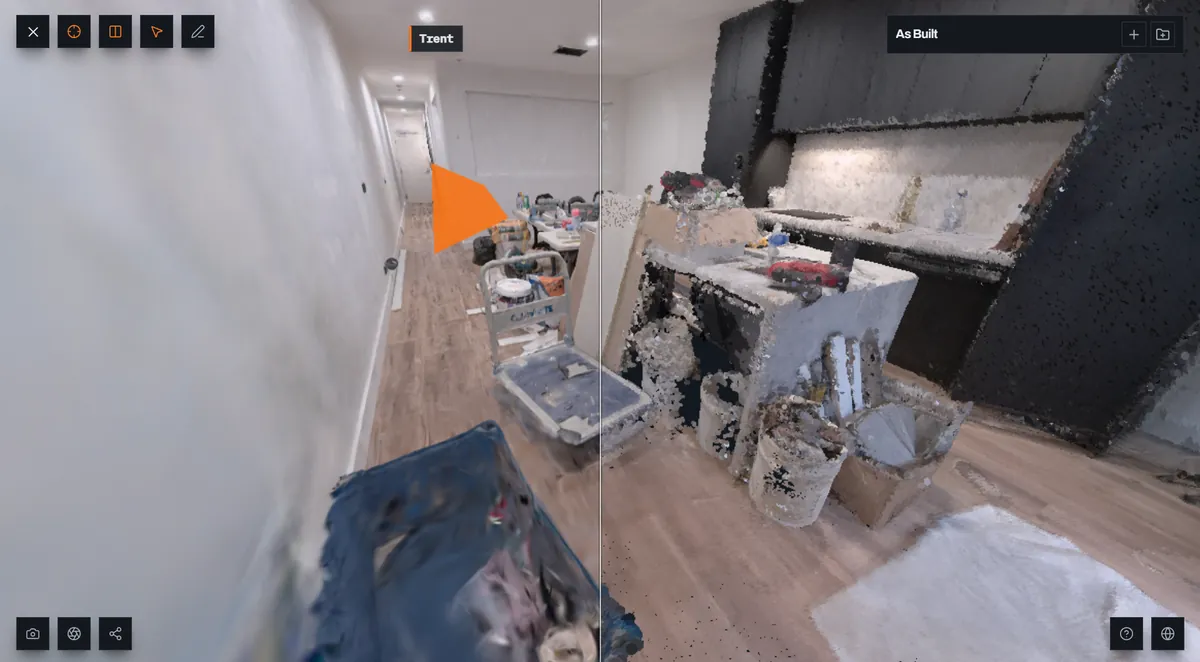
Meet in the scene with voice, a laser pointer and side-by-side A/B views. Send the invite from Outlook or Google Calendar.
From a drone survey or handheld scan to a link your client can open.

Step 1
Drag in point clouds, gaussian splats, meshes, GeoTIFF, GeoJSON or DXF from your drone or scanner software. A Share scanner project can come in as a whole folder.

Step 2
Layers line up in real-world coordinates. Add notes, measurements and live data, then publish.
Step 3
Send the link. It opens in a browser on a laptop, tablet or phone, with nothing to install.
Exports from drone and scanner software, plus live map services.
Clients always view free. You pay for published projects and storage.
15 GB included
Free
Included with C1 / C1 Pro
250 GB included
A$99/mo
A$990/yr
1 TB included
A$299/mo
A$2,990/yr
Storage by agreement
Prices AUD, including GST. Annual billing includes two months free. Extra storage on request. Unpublished projects don’t count toward your limit. C1 and C1 Pro include 12 months of Studio.